Assembly District 61
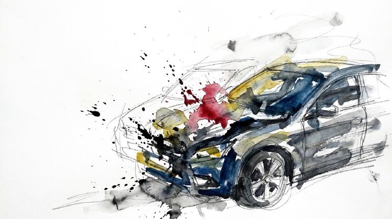
Crash Narratives
Assembly District 61: Traffic Crash Statistics
Crash Counter for AD 61 544 crashes • 1 deaths
About these crash totals
Counts come from NYC police crash reports (NYPD Motor Vehicle Collisions on NYC Open Data). We sum all crashes, injuries, and deaths for this area across the selected time window shown on the card. Injury severity follows DOT's KABCO definitions mapped from the NYPD Person table (injury status, injury type, and injury location).
- Crashes: number of police‑reported collisions (all road users).
- All injuries: people with any reported injury (KABCO A/B/C or generic "injured").
- Moderate / Serious: suspected minor + suspected serious injuries (KABCO B + A).
- Deaths: killed or apparent death reported by police (KABCO K).
Change badges (arrows and percentages) compare the selected window with the same period last year whenever we have enough history. The “From 2022” view shows totals across the full span since 2022. When a comparison window isn’t available the badge shows an em dash.
Notes: Police reports can be corrected after initial publication. We cannot verify "death within 30 days" or hospital outcomes, so small differences from DOT totals are possible. Minor incidents without a police report are not included.
CloseCaught Speeding in AD 61 KXH2766 — 173 times
- 173 speed-camera tickets citywide in 12 monthsNY KXH2766 · 2022 Gray Kia SedanCaught here 69 times in the last 12 months.Typically speeds citywide in: Tompkinsville-Stapleton-Clifton-Fox Hills (38), Mariner's Harbor-Arlington-Graniteville (33), and West New Brighton-Silver Lake-Grymes Hill (18).
- 165 speed-camera tickets citywide in 12 monthsNJ A35WNJ · 2024 Audi SedaCaught here 1 time in the last 12 months.Typically speeds citywide in: East Flatbush-Remsen Village (17), East Flatbush-Rugby (15), and Crown Heights (North) (14).
- 163 speed-camera tickets citywide in 12 monthsVA TLN8692 · 2013 White Ford BuCaught here 7 times in the last 12 months.Typically speeds citywide in: East Flatbush-Rugby (31), Flatlands (19), and Canarsie (15).
- 160 speed-camera tickets citywide in 12 monthsPA MMN1453 · 2021 Gray BMW CpCaught here 2 times in the last 12 months.Typically speeds citywide in: Flatlands (20), Flatbush (16), and East Flatbush-Erasmus (15).
- 149 speed-camera tickets citywide in 12 monthsNY LHW5785 · 2024 Black Toyota SuburbanCaught here 1 time in the last 12 months.Typically speeds citywide in: Crown Heights (North) (14), Bedford-Stuyvesant (West) (12), and Ocean Hill (11).
About this list
This ranks vehicles caught speeding in this area during the latest 12-month window by the number of NYC school-zone speed-camera violations they received anywhere in the city during that same window.
Camera violations are issued by NYC DOT’s program. Counts reflect issued tickets and may omit dismissed or pending cases. Plate text is shown verbatim as recorded.
CloseDangerous Schools in AD 61 Loading school hotspots...
| School | Crashes
Injuries
Child injuries
Deaths |
|---|
Dangerous Streets in AD 61 Loading street hotspots...
| Street | Crashes
Injuries
Child injuries
Deaths |
|---|
Dangerous Intersections in AD 61 Loading intersection hotspots...
| Intersection | Crashes
Injuries
Child injuries
Deaths |
|---|
Crash Finder
Try Crash Finder
Look up any street, school, address, or intersection to see how safe the streets are.
AD 61 Hot Spots Danger zones and recent crashes
Traffic Safety Timeline Tap to view recent events
Carnage in AD 61 6 Contusion/Bruise (Lower leg/foot)
▸ Killed 1
▸ Crush Injuries 1
▸ Severe Bleeding 1
▸ Concussion 2
▸ Fracture/Dislocation 5
▸ Internal Injury 5
▸ Whiplash 15
▸ Contusion/Bruise 20
▸ Abrasion 17
▸ Pain/Nausea 4
Crashes by Hour in AD 61 2 PM • 36 injuries ↑80%
Who is getting hurt? Kids 28 injuries ↑22% Seniors 30 injuries ↑88%
Toggle on at least one mode to see people totals.
Totals count people injured or killed. Use the mode filters above to focus the stacks.
Dangerous Bike Lanes in AD 61 Loading bike lane hotspots...
| Bike lane | Crashes
Cyclist injuries
Child injuries
Cyclist deaths |
|---|
What Crashes Cost Here Loading estimate...
Loading crash cost estimate...
The three blocks below show direct costs, other harm, and the total for crashes with injuries, crashes without injuries, and all crashes together.
How we calculate this
We calculate these costs using a method developed by the National Highway Traffic Safety Administration, or NHTSA. It gives one set of costs for crashes with injuries and another for crashes with no reported injuries.
Crashes with injuries cost much more because the method includes things like lost work, medical care, and long-term harm. NHTSA says crash costs include "lost productivity, medical, legal and court costs, emergency service, insurance administration, congestion, property damage, and workplace losses."
These are estimates, not bills. "Other harm" is the part of the broader estimate that goes beyond direct bills and insurance claims. It captures pain, disability, and lost quality of life.
Download the math (CSV) · Download the math (JSON) · Method and sources
Preventable Speeding 4,133 16+ offenders ↓59%
Repeat School-Zone Speeding Offenders
- ≥ 6: 10,054 (2026 year-to-date) • Prev: 25,546 2025 year-to-date
- ≥ 16: 4,133 (2026 year-to-date) • Prev: 10,170 2025 year-to-date
Pedestrian Injuries 100% by Cars and Trucks ↓16%
About this chart
We group pedestrian injuries and deaths by the vehicle type that struck them (as recorded in police reports). Use the year selector to compare the current window with the prior period.
- Trucks/Buses, SUVs/Cars, Mopeds, and Bikes reflect the broad categories we use to track vehicle harm.
- Counts include people on foot only; crashes with no injured pedestrians do not appear in this card.
Notes: Police classification can change during investigations. Small categories may have year-to-year variance.
CloseAssembly Member Charles Fall B (73)
District 61
- 2022-12-30 · Leadership · Streetsblog NYC · ↑ helps gradeBrooklynites want Grand Army Plaza to serve people, not cars. Hundreds called for car-free space, protected bike lanes, and safer crossings. The plaza’s chaotic traffic traps pedestrians. The city’s paint-and-plastic fixes have failed. Residents demand bold change. The city must listen.
- 2022-12-30 · Leadership · Streetsblog NYC · ↓ hurts gradeA reckless driver crashed an Audi SUV through a barrier onto LIRR tracks in Brooklyn. One man died. His passenger suffered critical injuries. The SUV had 13 speeding tickets. Police blamed a 'medical episode,' but witnesses saw a u-turn and high speed.
- 2022-12-28 · Leadership · Streetsblog NYC · ↓ hurts gradeA pickup driver with 17 school-zone speeding tickets killed Gerardo Cielo Ahuatl on a Williamsburg corner known for danger. The truck, owned by JCDecaux, kept rolling despite 30 violations. No charges. Paint and plastic flappers offered no shield. Concrete came too late.
- 2022-12-28 · Leadership · Streetsblog NYC · ↑ helps gradeThe Streetsie Awards spotlight films that show how cities can save lives. Eckerson’s camera finds danger and hope. Protected bike lanes, open streets, and car-free living get the focus. Jersey City and Hoboken show what’s possible: zero deaths. New York lags. The films demand better.
- 2022-06-03 · Leadership · Streetsblog NYC · ↑ helps gradeCycling slashes emissions faster than electric cars. Swapping car trips for bike rides cuts carbon now. Active travel means cleaner air, fewer cars, safer streets. The study shows: pedal power outpaces battery power in the race against climate disaster.
- 2022-06-02 · Leadership · nypost.com · ↑ helps gradeAssemblyman Mamdani and Senator Hoylman push for cameras in 50 protected bike lanes. Drivers who block lanes face $50 fines. DOT backs the plan. Lawmakers say enforcement is needed. Cyclists face danger daily. Cameras promise real consequences for reckless drivers.
- 2022-06-02 · Vote · Open States · ↓ hurts gradeSenate passed S 5602 to keep school zone speed cameras running longer. More eyes on reckless drivers. Lawmakers push back against speeding near kids. The vote was clear. The danger remains.
- 2022-05-31 · Vote · Open States · ↓ hurts gradeAssembly and Senate passed A 8933. The bill shields emergency vehicle operators from fines for traffic violations during medical calls. Vulnerable road users face more risk. Accountability weakens. Streets grow more dangerous.
- 2023-12-31 · Leadership · NYC Council – Legistar · ↓ hurts gradeCharles Fall Backs Misguided Unlimited Two Hour Transfer Plan
- 2023-12-29 · Leadership · brooklynpaper.com · ↑ helps gradeDowntown Brooklyn saw new public spaces, art, and transit upgrades in 2023. City leaders cut sidewalk sheds, opened plazas, and boosted subway access. Over $40 million was pledged for streets, transit, and pedestrian safety. Lincoln Restler and others pushed for these changes.
- 2023-12-28 · Leadership · Streetsblog NYC · ↓ hurts gradeA hit-and-run truck killed an 82-year-old cyclist on Northern Boulevard. The driver fled. This marks the 29th cyclist death in 2023. Councilmember Brooks-Powers blasted DOT for missing legal bike lane targets. Streets remain deadly. Progress is slow. Accountability is lacking.
- 2023-12-21 · Leadership · Streetsblog NYC · ↑ helps gradeSanitation will plow bike lanes and roads at the same time. No more waiting. No more trade-offs. Commissioner Tisch says every street gets cleared together. Cyclists will not be left stranded in snow. The city finally treats bike lanes as vital.
- 2023-06-08 · Leadership · Streetsblog NYC · ↑ helps gradeState Senator Brad Hoylman-Sigal wants OMNY to work with Citi Bike. He calls for a unified payment system to break down barriers for riders. The move could make bike-share easier, but fractured agencies and costly upgrades stand in the way.
- 2023-06-06 · Vote · Open States · ↑ helps gradeAlbany gets speed cameras near schools. Lawmakers pass A 7043. Cameras catch drivers who endanger kids. The program runs until 2028. Streets near schools face new watchful eyes.
- 2023-06-06 · Vote · Open States · ↑ helps gradeAlbany gets speed cameras near schools. Lawmakers pass A 7043. Cameras catch drivers who endanger kids. The program runs until 2028. Streets near schools face new watchful eyes.
- 2023-06-06 · Vote · Open States · ↑ helps gradeFall votes yes to require recall checks before used car sales.
- 2024-12-30 · Leadership · Streetsblog NYC · ↓ hurts gradeGovernor Hochul halted Manhattan’s congestion pricing days before launch. Years of planning and billions for transit hung in the balance. The MTA froze upgrades. Hochul revived the toll months later, but trust and funding took the hit. Riders and streets paid the price.
- 2024-12-29 · Leadership · Streetsblog NYC · ↓ hurts gradeLyft raised Citi Bike e-bike fees again. This marks the third hike in a year. Per-minute rates climb for both members and non-members. Unlock fees go up. Annual membership holds steady. Riders grumble. The city’s price caps hold. Expansion plans continue.
- 2024-12-27 · Leadership · Streetsblog NYC · ↑ helps gradeMayor Adams missed legal targets for bus and bike lanes. DOT built only a fraction of what the law demands. Commutes drag for the city’s poorest. Council and advocates slam the mayor. Streets stay dangerous. Promises broken. Riders and walkers pay the price.
- 2024-12-23 · Leadership · Streetsblog NYC · ↑ helps grade2024 saw bold moves and setbacks for street safety. Congestion pricing staggered forward. Pedestrian braking tech became law. Atlanta banned right-on-red. Cities poured millions into transit. Yet, the death toll from cars barely budged. Streets remain dangerous. The fight continues.
- 2024-06-10 · Leadership · brooklynpaper.com · ↓ hurts gradeAngry Brooklynites rallied at Broadway Junction. They blasted Governor Hochul for halting congestion pricing. Signs demanded clean air and fast trains. Council Member Lincoln Restler called it betrayal. Protesters warned: more cars, less transit, and vulnerable riders left behind.
- 2024-06-09 · Leadership · amny.com · ↓ hurts gradeAnger filled Broadway Junction. Protesters called out Governor Hochul for halting congestion pricing. Councilmember Lincoln Restler said the city was betrayed. Riders demanded better buses, trains, and less car traffic. Without funding, vulnerable New Yorkers face longer waits and dangerous streets.
- 2024-06-07 · Leadership · streetsblog.org · ↓ hurts gradeAlbany lawmakers left town. Hochul froze congestion pricing. The MTA lost $1 billion. Projects for safer, more accessible transit now hang in limbo. Riders, walkers, and cyclists face a bleaker future. No fix. No plan. Only confusion and risk.
- 2024-06-07 · Vote · Open States · ↑ helps gradeAssembly passes A 7652. Schenectady gets school speed cameras. Law aims to slow drivers near kids. Cameras expire in 2028. Vote split. Streets may get safer for children on foot.
- 2025-12-31 · Leadership · Brooklyn Paper · ↑ helps gradeA new mayor vows faster, free buses as fares rise. Congestion pricing cuts cars. Streets grow a bit safer for people on foot and bike.
- 2025-12-09 · Leadership · Streetsblog NYC · ↑ helps gradeA Queens judge scrubbed a protected bike lane on a deadly strip. The move yanks cyclists into traffic and leaves walkers in the blast zone of speeding steel.
- 2025-12-05 · Leadership · Streetsblog NYCStreetsblog hails New York’s Vision Zero gains as other cities stall. Deaths drop here, but the blood still runs. The slogan works only when leaders choose courage.
- 2025-12-04 · Leadership · Streetsblog NYC · ↑ helps gradeState DOT’s Route 9 draft trims danger at the margins, but keeps bikes in the kill zone and walkers in the fumes while parking and car speed still rule.
- 2025-06-11 · Vote · Open States · ↓ hurts gradeSenate passed S 7785. The bill carves out large Mitchell-Lama housing from bus traffic rules. Lawmakers voted yes. The carve-out weakens enforcement. Streets grow less safe for people on foot and bike.
- 2025-06-11 · Vote · Open States · ↓ hurts gradeWhite Plains gets speed cameras near schools. Lawmakers move fast. Most vote yes. Cameras catch drivers who endanger kids. Program ends 2030. Streets may slow. Danger faces children every day.
- 2025-06-10 · Leadership · Streetsblog NYC · ↑ helps gradeThird Avenue will lose car lanes. A protected bike lane and bus lane will take their place. Pedestrian islands and wider sidewalks will rise. Community Board 6 backed the plan. The city aims to calm deadly traffic and give space to people.
- 2025-06-09 · Leadership · Streetsblog NYC · ↑ helps gradeDOT wants a center-running bus lane on Flatbush Avenue. Council members back it. The plan could cut car lanes, add bus islands, and calm deadly traffic. The mayor must decide. Pedestrians and riders wait. The street’s future hangs in the balance.
- 2026-06-09 · Leadership · Streetsblog NYC · ↑ helps gradeDOT told CB2 it will carve a protected bike lane on Adams Street and Boerum Place. Lanes shrink. Parking goes. Sightlines open. A key Brooklyn Bridge approach shifts from car storage to safer travel.
- 2026-06-02 · Leadership · Streetsblog NYC · ↑ helps gradeCity Hall said Mayor Mamdani nominated Janette Sadik-Khan and Melanie Hartzog to the MTA Board. It’s a power move over buses, fares, and service. No street-safety action is in the record.
- 2026-05-19 · Leadership · AMNY · ↑ helps gradeDOT and NYU launched an “E‑Bike Health” study. It will track e‑bike routes and health data. For now, it changes no street rules. Riders and walkers still face fast, crowded corridors.
- 2026-05-13 · Leadership · Brooklyn Paper · ↑ helps gradeMayor Mamdani’s executive budget steers more money to DOT lanes. It backs protected busways and bike routes. The aim is less chaos, more space for people outside cars.
853 Forest Ave., Staten Island, NY 10310
718-442-9932
Room 729, Legislative Office Building, Albany, NY 12248
518-455-4677
Borough President Vito J. Fossella —
Council Member Kamillah Hanks C (57)
District 49
- 2024-12-19 · Vote · NYC Council – Legistar · ↓ hurts gradeHanks votes yes on bill requiring FDNY consultation for street projects.
- 2024-11-13 · Sponsor · NYC Council – Legistar · ↓ hurts gradeCouncil bill targets shuttered schools. Annual study flags closed sites. Speed cameras pulled from dead zones. Streets lose watchful eyes. Vulnerable walkers and riders left exposed.
- 2024-09-26 · Sponsor · NYC Council – LegistarCouncil bill slashes legal parking time for big rigs. Ninety minutes max for tractor-trailers. Three hours for other commercial trucks. Streets clear faster. Heavy metal moves on.
- 2024-09-26 · Vote · NYC Council – Legistar · ↑ helps gradeCouncil ends jaywalking penalties. Pedestrians now cross anywhere, any time. No summons. Law strips drivers of excuses. Streets shift. Power tilts to people on foot.
- 2024-05-16 · Sponsor · NYC Council – Legistar · ↑ helps gradeCouncil moves to light up step streets. At least 25 stairways each year will get new lamps. Dark paths become visible. Pedestrians gain ground. Shadows shrink. Danger loses its cover.
- 👎 Negative2024-05-16 · Sponsor · NYC Council – Legistar · ↓ hurts gradeCouncil bill targets repeat pedal-assist bike violators. Three strikes trigger a mandatory safety course. Ignore the course, lose your bike. DOT will track results. Three-year pilot. Enforcement, not education, leads.
- 2024-04-18 · Sponsor · NYC Council – Legistar · ↑ helps gradeCouncil orders swift removal of abandoned and unplated cars. Streets clear in 72 hours. Police target vehicles with missing or fake plates. Fewer hazards for those on foot and bike.
- 2024-03-07 · Sponsor · NYC Council – Legistar · ↓ hurts gradeCouncil wants every e-bike and scooter tagged and tracked. Plates on wheels. Riders face new rules. Lawmakers say it’s about order. The bill sits in committee. Streets wait.
- 2025-12-26 · Leadership · Brooklyn Paper · ↑ helps gradeCongestion tolls hit cars hard below 61st. Traffic thinned. Air cleared. Trains shifted. MetroCards died. Riders paid more while streets grew a little safer to walk and ride.
- 2025-07-14 · Sponsor · NYC Council – Legistar · ↓ hurts gradeCouncil bill lets ambulettes drive and double-park in bus lanes. More vehicles in bus lanes mean more risk for people walking, biking, and waiting at curbs. Danger grows where curb chaos reigns.
- 2025-06-30 · Vote · NYC Council – Legistar · ↑ helps gradeCouncil orders swift removal of abandoned, derelict cars. Streets clear in 72 hours. No plates, no stickers, no excuses. Police and sanitation must act. Safer crossings for all who walk, ride, or wait.
- 2025-06-11 · Sponsor · NYC Council – LegistarCouncil bill orders bike and scooter share firms to show road rules at docks and in apps. Riders must review rules yearly. No extra fees. Aim: clear, visible reminders. Committee review underway.
- 2025-06-11 · Sponsor · NYC Council – LegistarCouncil bill orders bike and scooter share firms to show road rules at docks and in apps. Riders must review rules yearly. No extra fees. Aim: clear, visible reminders. Committee review underway.
- 2025-06-11 · Sponsor · NYC Council – LegistarCouncil bill orders bike and scooter share firms to show road rules on apps and stations. Riders must review rules yearly. No extra fees. Aim: clear, visible rules for all. Committee review underway.
- 2025-06-11 · Sponsor · NYC Council – LegistarCouncil bill demands bike and scooter share firms post road rules at stations and in apps. Riders must review rules yearly. No charge for time spent reading. City aims for clarity, not confusion.
- 2025-06-11 · Sponsor · NYC Council – Legistar · ↑ helps gradeHanks co-sponsors bill to create St. George–Bay Ridge ferry service.
- 2026-02-24 · Sponsor · NYC Council – Legistar · ↑ helps gradeInt 0704-2026 landed in committee. It would mandate regular ferry service at Canarsie Pier in Brooklyn. A new route. A new rush to the waterfront.
- 2026-02-24 · Sponsor · NYC Council – LegistarHanks co-sponsors Canarsie Pier ferry service bill with no safety impact.
- 2026-02-12 · Sponsor · NYC Council – LegistarInt 0672-2026 moved to committee. It would cap tractor-trailer and trailer parking at 90 minutes. The curb would turn over faster. Enforcement and signs would decide what changes on the street.
- 2026-02-12 · Sponsor · NYC Council – LegistarInt 0672-2026 would cut long truck parking. Tractor-trailers and similar rigs could stay 90 minutes, not three hours. It sits in the Transportation and Infrastructure Committee.
130 Stuyvesant Place, 6th Floor, Staten Island, NY 10301
718-556-7370
250 Broadway, Suite 1813, New York, NY 10007
212-788-6972
Police Precinct NYPD 120th Precinct —
Other Geographies See nearby areas
▸ Other Geographies
AD 61 Assembly District 61 sits in Staten Island, District 49, Precinct 120.
It contains Manhattan CB 1, Staten Island CB 1, Financial District-Battery Park City, The Battery-Governors Island-Ellis Island-Liberty Island, St. George-New Brighton, Tompkinsville-Stapleton-Clifton-Fox Hills, West New Brighton-Silver Lake-Grymes Hill, Westerleigh-Castleton Corners, Port Richmond, Mariner's Harbor-Arlington-Graniteville, Snug Harbor.
▸ See also
