Council District 20
Crash Narratives
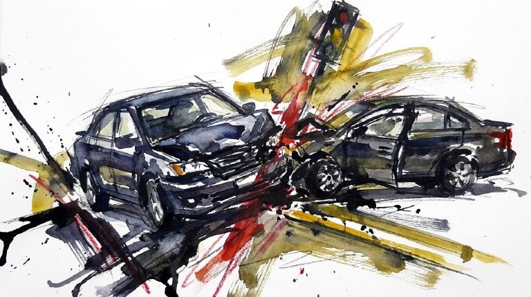
Queens CD20 sees a hard week of crashes and injuries
Council District 20 had 20 crashes in seven days with 27 injuries.
From May 30 to June 6 Council District 20 saw 20 crashes. Three people had serious injuries and 24 had moderate injuries. No one was killed.
On June 4 a driver disregarded traffic control on 58th Avenue at 10:25 p.m. Two children ages 10 and 13 were injured. That same week drivers hit pedestrians while turning on Roosevelt Avenue and Main Street. This district has triggered three times in 90 days and three times in 365 days. Council Member Sandra Ung should demand DOT fixes on these corridors now.
- 20 crashes in last 7 days
- 3 serious injuries
- A driver disregarded traffic control on 58th Avenue and crashed into another car at night. Two children, 10 and 13, were among the injured.
- A driver in Queens failed to yield and crashed into another vehicle near Negundo Avenue and Robinson Street. Two little boys, ages 3 and 4, suffered concussions.
- A sedan driver making a left turn failed to yield and hit a 42-year-old pedestrian on Roosevelt Avenue at College Point Boulevard. Police recorded hip and upper-leg injuries and whiplash.
Council District 20 turns loud after kids hurt in two crashes
Two crashes hit Council District 20 in seven days. Three people suffered serious injuries. Children were among the hurt.
From May 28 to June 4, Council District 20 saw two crashes. Three people suffered serious injuries. The district is usually quiet. It has now fired twice in 90 days.
On 58th Avenue a driver disregarded traffic control at night. A 10 year old girl and a 13 year old boy were injured. Near Negundo Avenue and Robinson Street a driver failed to yield. Two boys ages 3 and 4 suffered concussions. Council Member Sandra Ung should press DOT to slow these corridors now.
- 2 crashes in last 7 days
- 3 serious injuries
- A driver disregarded traffic control on 58th Avenue and crashed into another car at night. Two children, 10 and 13, were among the injured.
- A driver in Queens failed to yield and crashed into another vehicle near Negundo Avenue and Robinson Street. Two little boys, ages 3 and 4, suffered concussions.
Council District 20: Traffic Crash Statistics
Crash Counter for District 20 649 crashes • 1 deaths
About these crash totals
Counts come from NYC police crash reports (NYPD Motor Vehicle Collisions on NYC Open Data). We sum all crashes, injuries, and deaths for this area across the selected time window shown on the card. Injury severity follows DOT's KABCO definitions mapped from the NYPD Person table (injury status, injury type, and injury location).
- Crashes: number of police‑reported collisions (all road users).
- All injuries: people with any reported injury (KABCO A/B/C or generic "injured").
- Moderate / Serious: suspected minor + suspected serious injuries (KABCO B + A).
- Deaths: killed or apparent death reported by police (KABCO K).
Change badges (arrows and percentages) compare the selected window with the same period last year whenever we have enough history. The “From 2022” view shows totals across the full span since 2022. When a comparison window isn’t available the badge shows an em dash.
Notes: Police reports can be corrected after initial publication. We cannot verify "death within 30 days" or hospital outcomes, so small differences from DOT totals are possible. Minor incidents without a police report are not included.
CloseCaught Speeding in CD 20 KXM8750 — 178 times
- 178 speed-camera tickets citywide in 12 monthsNY KXM8750 · 2023 Black Mitsubishi SuburbanCaught here 2 times in the last 12 months.Typically speeds citywide in: St. Albans (23), South Jamaica (16), and Laurelton (15).
- 165 speed-camera tickets citywide in 12 monthsNJ A35WNJ · 2024 Audi SedaCaught here 2 times in the last 12 months.Typically speeds citywide in: East Flatbush-Remsen Village (17), East Flatbush-Rugby (15), and Crown Heights (North) (14).
- 155 speed-camera tickets citywide in 12 monthsPA MGT2007 · 2004 Gray Lincoln SedanCaught here 1 time in the last 12 months.Typically speeds citywide in: Jamaica (77), Hollis (56), and Queens Village (7).
- 136 speed-camera tickets citywide in 12 monthsNY 20918NE · 2023 White Ford VanCaught here 2 times in the last 12 months.Typically speeds citywide in: Bellerose (8), Queens Village (7), and East New York-New Lots (6).
- 126 speed-camera tickets citywide in 12 monthsNY LXZ7874 · 2025 Gray Chevrolet PickupCaught here 16 times in the last 12 months.Typically speeds citywide in: College Point (28), East Elmhurst (18), and Whitestone-Beechhurst (14).
About this list
This ranks vehicles caught speeding in this area during the latest 12-month window by the number of NYC school-zone speed-camera violations they received anywhere in the city during that same window.
Camera violations are issued by NYC DOT’s program. Counts reflect issued tickets and may omit dismissed or pending cases. Plate text is shown verbatim as recorded.
CloseDangerous Schools in CD 20 Loading school hotspots...
| School | Crashes
Injuries
Child injuries
Deaths |
|---|
Dangerous Streets in CD 20 Loading street hotspots...
| Street | Crashes
Injuries
Child injuries
Deaths |
|---|
Dangerous Intersections in CD 20 Loading intersection hotspots...
| Intersection | Crashes
Injuries
Child injuries
Deaths |
|---|
Crash Finder
Try Crash Finder
Look up any street, school, address, or intersection to see how safe the streets are.
CD 20 Hot Spots Danger zones and recent crashes
Traffic Safety Timeline Tap to view recent events
Carnage in CD 20 9 Contusion/Bruise (Lower leg/foot)
▸ Killed 1
▸ Crush Injuries 6
▸ Severe Bleeding 1
▸ Concussion 3
▸ Fracture/Dislocation 2
▸ Internal Injury 8
▸ Whiplash 33
▸ Contusion/Bruise 29
▸ Abrasion 11
▸ Pain/Nausea 15
Crashes by Hour in CD 20 6 PM • 26 injuries ↓7.1%
Who is getting hurt? Kids 20 injuries ↓29% Seniors 51 injuries ↑4.1%
Toggle on at least one mode to see people totals.
Totals count people injured or killed. Use the mode filters above to focus the stacks.
Dangerous Bike Lanes in CD 20 Loading bike lane hotspots...
| Bike lane | Crashes
Cyclist injuries
Child injuries
Cyclist deaths |
|---|
What Crashes Cost Here Loading estimate...
Loading crash cost estimate...
The three blocks below show direct costs, other harm, and the total for crashes with injuries, crashes without injuries, and all crashes together.
How we calculate this
We calculate these costs using a method developed by the National Highway Traffic Safety Administration, or NHTSA. It gives one set of costs for crashes with injuries and another for crashes with no reported injuries.
Crashes with injuries cost much more because the method includes things like lost work, medical care, and long-term harm. NHTSA says crash costs include "lost productivity, medical, legal and court costs, emergency service, insurance administration, congestion, property damage, and workplace losses."
These are estimates, not bills. "Other harm" is the part of the broader estimate that goes beyond direct bills and insurance claims. It captures pain, disability, and lost quality of life.
Download the math (CSV) · Download the math (JSON) · Method and sources
Preventable Speeding 1,400 16+ offenders ↓73%
Repeat School-Zone Speeding Offenders
- ≥ 6: 3,779 (2026 year-to-date) • Prev: 14,023 2025 year-to-date
- ≥ 16: 1,400 (2026 year-to-date) • Prev: 5,257 2025 year-to-date
Pedestrian Injuries 98% by Cars and Trucks ↓8.3%
About this chart
We group pedestrian injuries and deaths by the vehicle type that struck them (as recorded in police reports). Use the year selector to compare the current window with the prior period.
- Trucks/Buses, SUVs/Cars, Mopeds, and Bikes reflect the broad categories we use to track vehicle harm.
- Counts include people on foot only; crashes with no injured pedestrians do not appear in this card.
Notes: Police classification can change during investigations. Small categories may have year-to-year variance.
CloseCouncil Member Sandra Ung C (79)*

District 20
- 2024-12-19 · Vote · NYC Council – Legistar · ↓ hurts gradeUng votes yes on bill requiring FDNY consultation for street projects.
- 2024-11-18 · Leadership · nypost.com · ↑ helps gradeCity Council passed a bill to clean up battered newsracks. Erik Bottcher led the charge. The law forces owners to post contact info and lets DOT set strict standards. The goal: clear sidewalks, fewer obstacles, safer passage for all.
- 2024-09-26 · Sponsor · NYC Council – LegistarCouncil bill slashes legal parking time for big rigs. Ninety minutes max for tractor-trailers. Three hours for other commercial trucks. Streets clear faster. Heavy metal moves on.
- 2024-09-26 · Vote · NYC Council – Legistar · ↓ hurts gradeCouncil ends jaywalking penalties. Pedestrians now cross anywhere, any time. No summons. Law strips drivers of excuses. Streets shift. Power tilts to people on foot.
- 2024-05-16 · Sponsor · NYC Council – Legistar · ↑ helps gradeCouncil moves to light up step streets. At least 25 stairways each year will get new lamps. Dark paths become visible. Pedestrians gain ground. Shadows shrink. Danger loses its cover.
- 2024-04-18 · Sponsor · NYC Council – LegistarCouncil moves to hike fines for illegal ATVs and dirt bikes. First offense: $375–$750. Repeat: $750–$1,500. Law aims at reckless riders who menace city streets and endanger lives.
- 2024-04-18 · Sponsor · NYC Council – Legistar · ↑ helps gradeCouncil orders swift removal of abandoned and unplated cars. Streets clear in 72 hours. Police target vehicles with missing or fake plates. Fewer hazards for those on foot and bike.
- 2024-04-14 · Leadership · Streetsblog NYC · ↓ hurts gradeVandals tore hundreds of saplings from Kissena Park. Some trees vanished. Others lay dead in the dirt. ATV tracks scarred the ground. Volunteers, furious, found their work destroyed. The park’s greenway, a lifeline for cyclists, now stands exposed and wounded.
- 2025-10-29 · Sponsor · NYC Council – Legistar · ↑ helps gradeInt 1439-2025 would require the NYPD to assign at least one crossing guard to every public and private K–8 school by Sept. 1, 2026. It places an adult between traffic and children at arrival and dismissal, changing street interactions around schools.
- 2025-06-30 · Vote · NYC Council – Legistar · ↑ helps gradeCouncil orders swift removal of abandoned, derelict cars. Streets clear in 72 hours. No plates, no stickers, no excuses. Police and sanitation must act. Safer crossings for all who walk, ride, or wait.
- 2025-05-01 · Vote · NYC Council – LegistarCouncil passes law. Taxis and for-hire cars must post bold warnings on rear doors. Riders face the message: look for cyclists before swinging the door. A move to cut dooring. City acts. Cyclists stay in the crosshairs.
- 2025-04-10 · Vote · NYC Council – Legistar · ↑ helps gradeCouncil passed a law forcing DOT to post sharp, regular updates on street safety projects. Progress on bike lanes, bus lanes, and signals must go public. No more hiding delays or cost overruns. The city must show its work.
- 2025-02-13 · Vote · NYC Council – Legistar · ↑ helps gradeCouncil orders DOT to repaint pavement lines within five days after resurfacing. Delays must be explained to the public. Clear markings mean fewer deadly gaps for walkers and riders.
- 2025-02-13 · Sponsor · NYC Council – LegistarCouncil pushes for a study and five-year plan to install tactile paving on city sidewalks. The bill targets safer streets for blind and low-vision New Yorkers. Sponsors demand action, not delay.
- 2026-04-30 · Sponsor · NYC Council – LegistarInt 0866-2026 targets surprise street upheaval. It orders DOT to post warning signs near long disruptions. Closures, reroutes, and station moves would have a clock and a contact.
- 2026-04-16 · Sponsor · NYC Council – LegistarUng co-sponsors bill expanding ferry service to Willets Point
- 2026-04-16 · Sponsor · NYC Council – LegistarUng co-sponsors Willets Point ferry service bill, with no safety impact.
- 2026-04-16 · Sponsor · NYC Council – LegistarUng co-sponsors Willets Point ferry service expansion bill.
136-21 Latimer Place, 1D, Flushing, NY 11354
718-888-8747
250 Broadway, Suite 1808, New York, NY 10007
212-788-7259
Borough President Donovan Richards Jr. —
Police Precinct NYPD 109th Precinct —
Other Geographies See nearby areas
▸ Other Geographies
District 20 Council District 20 sits in Queens, Precinct 109.
It contains Queens CB 7, Murray Hill-Broadway Flushing, East Flushing, Queensboro Hill, Flushing-Willets Point, Kissena Park, Auburndale.
▸ See also
