Council District 33
Crash Narratives
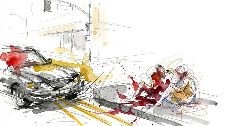
Council District 33 hit by a hard week of street violence
Council District 33 saw 21 crashes in 7 days. Six people were seriously injured and nine were moderately injured.
Council District 33 had 21 crashes from May 30 to June 6. Six people had serious injuries. Nine more had moderate injuries. Nobody was killed.
Police say a distracted driver hit two pedestrians near Flatbush Avenue Ext and Tillary Street on June 3. This district has triggered six alerts in 90 days. It has triggered six alerts in 365 days. Council Member Lincoln Restler should press DOT for fixes on Flatbush Avenue Ext and other repeat corridors.
- 21 crashes in last 7 days
- 6 serious injuries
- Police say a distracted driver hit two pedestrians near Flatbush Avenue Ext and Tillary Street. A 58-year-old man reported leg pain and nausea; a 36-year-old woman had bleeding and an arm injury.
- A motorcycle driver made a right turn at Kent Avenue and S 2nd Street and hit a 32-year-old cyclist. Police recorded improper passing or lane use.
- On Jay Street, an SUV driver making a left turn hit a 31-year-old cyclist. Police recorded obstructed or limited view; the rider was ejected and suffered a fractured or dislocated arm.
Council District 33: Traffic Crash Statistics
Crash Counter for District 33 1,001 crashes • 2 deaths
About these crash totals
Counts come from NYC police crash reports (NYPD Motor Vehicle Collisions on NYC Open Data). We sum all crashes, injuries, and deaths for this area across the selected time window shown on the card. Injury severity follows DOT's KABCO definitions mapped from the NYPD Person table (injury status, injury type, and injury location).
- Crashes: number of police‑reported collisions (all road users).
- All injuries: people with any reported injury (KABCO A/B/C or generic "injured").
- Moderate / Serious: suspected minor + suspected serious injuries (KABCO B + A).
- Deaths: killed or apparent death reported by police (KABCO K).
Change badges (arrows and percentages) compare the selected window with the same period last year whenever we have enough history. The “From 2022” view shows totals across the full span since 2022. When a comparison window isn’t available the badge shows an em dash.
Notes: Police reports can be corrected after initial publication. We cannot verify "death within 30 days" or hospital outcomes, so small differences from DOT totals are possible. Minor incidents without a police report are not included.
CloseCaught Speeding in CD 33 RUN1724 — 196 times
- 196 speed-camera tickets citywide in 12 monthsGA RUN1724 · 2020 Black BMW MpCaught here 1 time in the last 12 months.Typically speeds citywide in: Crown Heights (North) (88), Prospect Heights (19), and Spring Creek-Starrett City (12).
- 191 speed-camera tickets citywide in 12 monthsNY KZF9054 · 2023 Black Mitsubishi SuburbanCaught here 3 times in the last 12 months.Typically speeds citywide in: East New York-New Lots (13), Ocean Hill (11), and Crown Heights (North) (10).
- 176 speed-camera tickets citywide in 12 monthsGA SGY7043 · 2021 White Mercedes-Benz 4SCaught here 1 time in the last 12 months.Typically speeds citywide in: Canarsie (51), Sheepshead Bay-Manhattan Beach-Gerritsen Beach (19), and Baisley Park (14).
- 174 speed-camera tickets citywide in 12 monthsNY LHW6019 · 2024 Gray Toyota SedanCaught here 5 times in the last 12 months.Typically speeds citywide in: Crown Heights (North) (14), Ocean Hill (10), and East New York-New Lots (8).
- 173 speed-camera tickets citywide in 12 monthsNY KXH2766 · 2022 Gray Kia SedanCaught here 1 time in the last 12 months.Typically speeds citywide in: Tompkinsville-Stapleton-Clifton-Fox Hills (38), Mariner's Harbor-Arlington-Graniteville (33), and West New Brighton-Silver Lake-Grymes Hill (18).
About this list
This ranks vehicles caught speeding in this area during the latest 12-month window by the number of NYC school-zone speed-camera violations they received anywhere in the city during that same window.
Camera violations are issued by NYC DOT’s program. Counts reflect issued tickets and may omit dismissed or pending cases. Plate text is shown verbatim as recorded.
CloseDangerous Schools in CD 33 Loading school hotspots...
| School | Crashes
Injuries
Child injuries
Deaths |
|---|
Dangerous Streets in CD 33 Loading street hotspots...
| Street | Crashes
Injuries
Child injuries
Deaths |
|---|
Dangerous Intersections in CD 33 Loading intersection hotspots...
| Intersection | Crashes
Injuries
Child injuries
Deaths |
|---|
Crash Finder
Try Crash Finder
Look up any street, school, address, or intersection to see how safe the streets are.
CD 33 Hot Spots Danger zones and recent crashes
Traffic Safety Timeline Tap to view recent events
Carnage in CD 33 10 Whiplash (Back)
▸ Killed 2
▸ Crush Injuries 2
▸ Severe Bleeding 7
▸ Severe Lacerations 2
▸ Concussion 5
▸ Fracture/Dislocation 6
▸ Internal Injury 9
▸ Whiplash 32
▸ Contusion/Bruise 21
▸ Abrasion 10
▸ Pain/Nausea 25
Crashes by Hour in CD 33 2 PM • 38 injuries ↑12%
Who is getting hurt? Kids 24 injuries ↑26% Seniors 26 injuries ↑8.3%
Toggle on at least one mode to see people totals.
Totals count people injured or killed. Use the mode filters above to focus the stacks.
Dangerous Bike Lanes in CD 33 Loading bike lane hotspots...
| Bike lane | Crashes
Cyclist injuries
Child injuries
Cyclist deaths |
|---|
What Crashes Cost Here Loading estimate...
Loading crash cost estimate...
The three blocks below show direct costs, other harm, and the total for crashes with injuries, crashes without injuries, and all crashes together.
How we calculate this
We calculate these costs using a method developed by the National Highway Traffic Safety Administration, or NHTSA. It gives one set of costs for crashes with injuries and another for crashes with no reported injuries.
Crashes with injuries cost much more because the method includes things like lost work, medical care, and long-term harm. NHTSA says crash costs include "lost productivity, medical, legal and court costs, emergency service, insurance administration, congestion, property damage, and workplace losses."
These are estimates, not bills. "Other harm" is the part of the broader estimate that goes beyond direct bills and insurance claims. It captures pain, disability, and lost quality of life.
Download the math (CSV) · Download the math (JSON) · Method and sources
Preventable Speeding 2,008 16+ offenders ↓59%
Repeat School-Zone Speeding Offenders
- ≥ 6: 5,384 (2026 year-to-date) • Prev: 12,430 2025 year-to-date
- ≥ 16: 2,008 (2026 year-to-date) • Prev: 4,865 2025 year-to-date
Pedestrian Injuries 90% by Cars and Trucks ↑9.5%
About this chart
We group pedestrian injuries and deaths by the vehicle type that struck them (as recorded in police reports). Use the year selector to compare the current window with the prior period.
- Trucks/Buses, SUVs/Cars, Mopeds, and Bikes reflect the broad categories we use to track vehicle harm.
- Counts include people on foot only; crashes with no injured pedestrians do not appear in this card.
Notes: Police classification can change during investigations. Small categories may have year-to-year variance.
CloseCouncil Member Lincoln Restler A (100)

District 33
- 2024-12-19 · Vote · NYC Council – Legistar · ↑ helps gradeRestler votes no on bill requiring FDNY input on street projects.
- 2024-12-05 · Sponsor · NYC Council – Legistar · ↑ helps gradeCouncil bill bars cars from blocking crosswalks. No standing or parking within 20 feet. City must install daylighting barriers at 1,000 intersections yearly. Streets clear. Sightlines open. Danger cut.
- • Neutral2024-09-26 · Sponsor · NYC Council – LegistarCouncil bill slashes legal parking time for big rigs. Ninety minutes max for tractor-trailers. Three hours for other commercial trucks. Streets clear faster. Heavy metal moves on.
- 2024-09-26 · Sponsor · NYC Council – Legistar · ↑ helps gradeCouncil pushes Albany to let New York City ticket drivers who block bike lanes. Cameras would catch violators. Cyclists face deadly risk. Lawmakers demand action. Streets must protect the vulnerable.
- 2024-05-16 · Sponsor · NYC Council – Legistar · ↑ helps gradeCouncil moves to light up step streets. At least 25 stairways each year will get new lamps. Dark paths become visible. Pedestrians gain ground. Shadows shrink. Danger loses its cover.
- 2024-04-18 · Sponsor · NYC Council – LegistarCouncil moves to hike fines for illegal ATVs and dirt bikes. First offense: $375–$750. Repeat: $750–$1,500. Law aims at reckless riders who menace city streets and endanger lives.
- 2024-04-18 · Sponsor · NYC Council – Legistar · ↑ helps gradeCouncil orders swift removal of abandoned and unplated cars. Streets clear in 72 hours. Police target vehicles with missing or fake plates. Fewer hazards for those on foot and bike.
- 2024-04-18 · Sponsor · NYC Council – LegistarCouncil bill orders DOT to factor traffic enforcement agents into city safety plans. The move targets deadly streets. Sponsors demand action, not words. Vulnerable New Yorkers wait for safer crossings.
- 2025-11-25 · Leadership · City & State NY · ↑ helps gradeAdrienne Adams defended the outdoor dining program as continuity. Lawmakers pushed to restore pandemic-era, year-round curb cafes. Reclaiming curb space from cars can calm traffic and tend to improve safety for pedestrians and cyclists.
- 2025-10-29 · Sponsor · NYC Council – Legistar · ↓ hurts gradeCouncil bill would cap the clear pedestrian path in front of sidewalk cafes at eight feet. Introduced and sent to the Committee on Transportation and Infrastructure on Oct. 29, 2025. The change narrows walking space and raises conflict risk for pedestrians and cyclists.
- 2025-10-29 · Sponsor · NYC Council – LegistarInt 1446-2025 forces DOT to accept sidewalk and roadway cafe applications online and at public locations. Applicants can save drafts. It bars mandatory professional drawing approval while preserving DOT review of required clearances.
- 2025-10-29 · Sponsor · NYC Council – Legistar · ↑ helps gradeCouncil bill forces DOT to accept sidewalk and roadway cafe petitions online and at public offices, lets applicants save drafts, and bars DOT from requiring professional-drawn plans. Introduced and sent to the Transportation Committee on Oct 29, 2025.
- 2025-06-11 · Sponsor · NYC Council – LegistarCouncil bill orders bike and scooter share firms to show road rules at docks and in apps. Riders must review rules yearly. No extra fees. Aim: clear, visible reminders. Committee review underway.
- 2025-06-11 · Sponsor · NYC Council – LegistarCouncil bill orders bike and scooter share firms to show road rules on apps and stations. Riders must review rules yearly. No extra fees. Aim: clear, visible rules for all. Committee review underway.
- 2025-06-11 · Sponsor · NYC Council – LegistarCouncil bill demands bike and scooter share firms post road rules at stations and in apps. Riders must review rules yearly. No charge for time spent reading. City aims for clarity, not confusion.
- 2025-05-28 · Sponsor · NYC Council – Legistar · ↑ helps gradeCouncil pushes a bill to cut bike share costs for New Yorkers over 65. The measure aims to open city cycling to more seniors. The committee now weighs its next move.
- 2026-06-11 · Sponsor · NYC Council – LegistarRestler co-sponsors discounted CUNY bike share rate bill, no safety impact
- 2026-06-09 · Leadership · Streetsblog NYC · ↑ helps gradeDOT told CB2 it will carve a protected bike lane on Adams Street and Boerum Place. Lanes shrink. Parking goes. Sightlines open. A key Brooklyn Bridge approach shifts from car storage to safer travel.
- 2026-06-09 · Leadership · Streetsblog NYC · ↑ helps gradeBig rigs cut through State Street, then jam and back up. A truck hit a DOT sign, drove onto a sidewalk, and damaged a tree. Injuries and a pedestrian death shadow Third Ave as DOT reviews a new map.
- 2026-06-02 · Leadership · Streetsblog NYC · ↑ helps gradeAt a Council hearing, FDNY Commissioner Lillian Bonsignore backed bike lanes. She said they “put people in a safer place and they save lives.” She rejected claims they block fire response, but offered no firm deadline on reviews.
410 Atlantic Avenue, Brooklyn, NY 11217
718-875-5200
250 Broadway, Suite 1748, New York, NY 10007
212-788-7214
Borough President Antonio Reynoso —
Police Precinct NYPD 90th Precinct —
Other Geographies See nearby areas
▸ Other Geographies
District 33 Council District 33 sits in Brooklyn, Precinct 90.
It contains Brooklyn CB 1, Brooklyn CB 2, Greenpoint, Williamsburg, South Williamsburg, Brooklyn Heights, Downtown Brooklyn-DUMBO-Boerum Hill, Brooklyn Navy Yard.
▸ See also
