Senate District 11
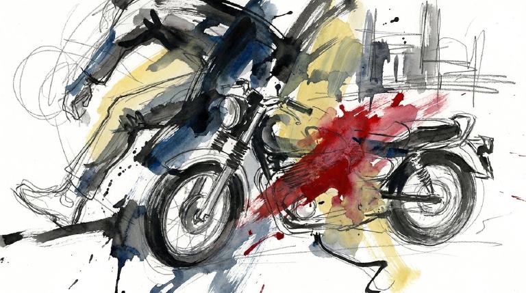
Crash Narratives
Senate District 11 hit by 55 crashes in one week
May 30 to June 6 saw 55 crashes in Senate District 11. Seven serious injuries followed. Six more were moderate.
Senate District 11 logged 55 crashes from May 30 through June 6. Seven people suffered serious injuries. Six more had moderate injuries.
On June 5 a driver passed too closely on 172nd Street near Jamaica Avenue. A 19 year old cyclist left with a fractured and dislocated arm and hand. A day earlier a driver turning right hit a 12 year old girl crossing with the signal on Willets Point Boulevard. This district has set off 11 alerts in 90 days. It has set off 11 in 365 days. State Senator Toby Stavisky can press the Senate to move street safety bills like S 1675 on vehicle pedestrian safety ratings.
- 55 crashes in last 7 days
- 7 serious injuries
- A driver passed too closely on 172nd Street near Jamaica Avenue and hit a 19-year-old cyclist. The teen suffered a fracture/dislocation to his arm and hand.
- A driver turning right in an SUV hit a 12-year-old girl crossing with the signal on Willets Point Boulevard. Police recorded failure to yield and driver inattention.
- A driver making a U-turn on 20th Avenue hit another driver near 21st Street. Police recorded turning improperly; a 54-year-old woman reported a concussion and neck injury.
Senate District 11: 7 severe crashes, 7 serious injuries
Senate District 11 recorded 7 severe crashes, 7 serious injuries since May 28. Severity level: severe injury surge.
What we know
- A driver turning right in an SUV hit a 12-year-old girl crossing with the signal on Willets Point Boulevard. Police recorded failure to yield and driver inattention. — 149 ST
- A driver hit a 28-year-old cyclist near 188th Street and 89th Avenue. Police recorded driver inattention/distraction, and the cyclist suffered a head injury. — 188 ST
- A driver going too fast hit a 34-year-old pedestrian near 188-72 85th Road in Queens. Police recorded unsafe speed and passing too closely. — QUEENS
What happens next
- Push leaders in Senate District 11 to fix the dangerous streets.
- 7 crashes in last 7 days
- 7 serious injuries
- A driver turning right in an SUV hit a 12-year-old girl crossing with the signal on Willets Point Boulevard. Police recorded failure to yield and driver inattention.
- A driver making a U-turn on 20th Avenue hit another driver near 21st Street. Police recorded turning improperly; a 54-year-old woman reported a concussion and neck injury.
- A driver making a right turn hit a school bus on Hillside Avenue at 211th Street. The bus driver, 51, was injured.
Senate District 11: Traffic Crash Statistics
Crash Counter for SD 11 1,519 crashes • 3 deaths
About these crash totals
Counts come from NYC police crash reports (NYPD Motor Vehicle Collisions on NYC Open Data). We sum all crashes, injuries, and deaths for this area across the selected time window shown on the card. Injury severity follows DOT's KABCO definitions mapped from the NYPD Person table (injury status, injury type, and injury location).
- Crashes: number of police‑reported collisions (all road users).
- All injuries: people with any reported injury (KABCO A/B/C or generic "injured").
- Moderate / Serious: suspected minor + suspected serious injuries (KABCO B + A).
- Deaths: killed or apparent death reported by police (KABCO K).
Change badges (arrows and percentages) compare the selected window with the same period last year whenever we have enough history. The “From 2022” view shows totals across the full span since 2022. When a comparison window isn’t available the badge shows an em dash.
Notes: Police reports can be corrected after initial publication. We cannot verify "death within 30 days" or hospital outcomes, so small differences from DOT totals are possible. Minor incidents without a police report are not included.
CloseCaught Speeding in SD 11 KXM7078 — 286 times
- 286 speed-camera tickets citywide in 12 monthsNY KXM7078 · 2022 Gray Ford PickupCaught here 1 time in the last 12 months.Typically speeds citywide in: East New York-New Lots (27), Crown Heights (North) (22), and Concourse-Concourse Village (16).
- 240 speed-camera tickets citywide in 12 monthsNY KWC3138 · 2022 Gray Mitsubishi SuburbanCaught here 1 time in the last 12 months.Typically speeds citywide in: Mount Hope (24), Fordham Heights (18), and Bedford Park (17).
- 206 speed-camera tickets citywide in 12 monthsNY LHW5598 · 2023 Black Toyota SedanCaught here 1 time in the last 12 months.Typically speeds citywide in: Mount Hope (23), Fordham Heights (17), and Claremont Village-Claremont (East) (14).
- 191 speed-camera tickets citywide in 12 monthsNY KZF9054 · 2023 Black Mitsubishi SuburbanCaught here 4 times in the last 12 months.Typically speeds citywide in: East New York-New Lots (13), Ocean Hill (11), and Crown Heights (North) (10).
- 178 speed-camera tickets citywide in 12 monthsNY KXM8750 · 2023 Black Mitsubishi SuburbanCaught here 22 times in the last 12 months.Typically speeds citywide in: St. Albans (23), South Jamaica (16), and Laurelton (15).
About this list
This ranks vehicles caught speeding in this area during the latest 12-month window by the number of NYC school-zone speed-camera violations they received anywhere in the city during that same window.
Camera violations are issued by NYC DOT’s program. Counts reflect issued tickets and may omit dismissed or pending cases. Plate text is shown verbatim as recorded.
CloseDangerous Schools in SD 11 Loading school hotspots...
| School | Crashes
Injuries
Child injuries
Deaths |
|---|
Dangerous Streets in SD 11 Loading street hotspots...
| Street | Crashes
Injuries
Child injuries
Deaths |
|---|
Dangerous Intersections in SD 11 Loading intersection hotspots...
| Intersection | Crashes
Injuries
Child injuries
Deaths |
|---|
Crash Finder
Try Crash Finder
Look up any street, school, address, or intersection to see how safe the streets are.
SD 11 Hot Spots Danger zones and recent crashes
Traffic Safety Timeline Tap to view recent events
Carnage in SD 11 17 Whiplash (Neck)
▸ Killed 3
▸ Crush Injuries 19
▸ Severe Bleeding 2
▸ Severe Lacerations 1
▸ Concussion 7
▸ Fracture/Dislocation 10
▸ Internal Injury 8
▸ Whiplash 39
▸ Contusion/Bruise 39
▸ Abrasion 20
▸ Pain/Nausea 14
Crashes by Hour in SD 11 5 PM • 59 injuries ↑34%
Who is getting hurt? Kids 60 injuries ↓26% Seniors 88 injuries ↓12%
Toggle on at least one mode to see people totals.
Totals count people injured or killed. Use the mode filters above to focus the stacks.
Dangerous Bike Lanes in SD 11 Loading bike lane hotspots...
| Bike lane | Crashes
Cyclist injuries
Child injuries
Cyclist deaths |
|---|
What Crashes Cost Here Loading estimate...
Loading crash cost estimate...
The three blocks below show direct costs, other harm, and the total for crashes with injuries, crashes without injuries, and all crashes together.
How we calculate this
We calculate these costs using a method developed by the National Highway Traffic Safety Administration, or NHTSA. It gives one set of costs for crashes with injuries and another for crashes with no reported injuries.
Crashes with injuries cost much more because the method includes things like lost work, medical care, and long-term harm. NHTSA says crash costs include "lost productivity, medical, legal and court costs, emergency service, insurance administration, congestion, property damage, and workplace losses."
These are estimates, not bills. "Other harm" is the part of the broader estimate that goes beyond direct bills and insurance claims. It captures pain, disability, and lost quality of life.
Download the math (CSV) · Download the math (JSON) · Method and sources
Preventable Speeding 7,539 16+ offenders ↓71%
Repeat School-Zone Speeding Offenders
- ≥ 6: 19,228 (2026 year-to-date) • Prev: 62,893 2025 year-to-date
- ≥ 16: 7,539 (2026 year-to-date) • Prev: 25,939 2025 year-to-date
Pedestrian Injuries 97% by Cars and Trucks ↓7.2%
About this chart
We group pedestrian injuries and deaths by the vehicle type that struck them (as recorded in police reports). Use the year selector to compare the current window with the prior period.
- Trucks/Buses, SUVs/Cars, Mopeds, and Bikes reflect the broad categories we use to track vehicle harm.
- Counts include people on foot only; crashes with no injured pedestrians do not appear in this card.
Notes: Police classification can change during investigations. Small categories may have year-to-year variance.
CloseState Senator Toby Stavisky A (92)

District 11
- 2022-06-01 · Vote · Open States · ↑ helps gradeAlbany passed A 8936. Cities get more state cash if they build complete streets. Lawmakers want safer roads. The bill sailed through both chambers. Money now follows safety.
- 2022-06-01 · Vote · Open States · ↓ hurts gradeAssembly and Senate passed A 8933. The bill shields emergency vehicle operators from fines for traffic violations during medical calls. Vulnerable road users face more risk. Accountability weakens. Streets grow more dangerous.
- 2022-06-01 · Vote · Open States · ↑ helps gradeStavisky votes yes in committee on ignition interlock monitor bill.
- 2022-06-01 · Vote · Open States · ↑ helps gradeStavisky votes yes in committee on ignition interlock monitor bill.
- 2023-06-08 · Vote · Open States · ↑ helps gradeAlbany gets speed cameras near schools. Lawmakers pass A 7043. Cameras catch drivers who endanger kids. The program runs until 2028. Streets near schools face new watchful eyes.
- 2023-06-06 · Vote · Open States · ↑ helps gradeAlbany gets speed cameras near schools. Lawmakers pass A 7043. Cameras catch drivers who endanger kids. The program runs until 2028. Streets near schools face new watchful eyes.
- 2023-06-01 · Vote · Open States · ↑ helps gradeSenate passes S 6808. The bill creates first responder safety zones. It sets speed limits in these zones. Lawmakers act after crashes and close calls. The vote is strong. The danger is real. The streets demand change.
- 2023-05-31 · Vote · Open States · ↑ helps gradeSenate passes S 2714. Bill pushes complete street design. Aim: safer roads for all. Pedestrians, cyclists, and riders get space. Car dominance challenged. Lawmakers move to cut street carnage.
- 2024-06-07 · Vote · Open States · ↑ helps gradeSenate backs S 9752. Mt. Vernon gets green light for up to 20 school speed zones. Law aims to slow cars near kids. Most senators vote yes. A few say no. Streets may change. Danger remains for the young.
- 2024-06-07 · Vote · Open States · ↑ helps gradeSenate backs S 9752. Mt. Vernon gets green light for up to 20 school speed zones. Law aims to slow cars near kids. Most senators vote yes. A few say no. Streets may change. Danger remains for the young.
- 2024-06-06 · Vote · Open States · ↑ helps gradeLawmakers back speed cameras near Kingston schools. Cameras catch drivers who speed. The bill passed both chambers. It sunsets in 2029. Children and families walk safer, but the fix is temporary.
- 2024-06-06 · Vote · Open States · ↑ helps gradeLawmakers back speed cameras near Kingston schools. Cameras catch drivers who speed. The bill passed both chambers. It sunsets in 2029. Children and families walk safer, but the fix is temporary.
- 2024-06-07 · Vote · Open States · ↑ helps gradeSenate backs S 9752. Mt. Vernon gets green light for up to 20 school speed zones. Law aims to slow cars near kids. Most senators vote yes. A few say no. Streets may change. Danger remains for the young.
- 2024-06-07 · Vote · Open States · ↑ helps gradeSenate backs S 9752. Mt. Vernon gets green light for up to 20 school speed zones. Law aims to slow cars near kids. Most senators vote yes. A few say no. Streets may change. Danger remains for the young.
- 2024-06-06 · Vote · Open States · ↑ helps gradeLawmakers back speed cameras near Kingston schools. Cameras catch drivers who speed. The bill passed both chambers. It sunsets in 2029. Children and families walk safer, but the fix is temporary.
- 2024-06-06 · Vote · Open States · ↑ helps gradeLawmakers back speed cameras near Kingston schools. Cameras catch drivers who speed. The bill passed both chambers. It sunsets in 2029. Children and families walk safer, but the fix is temporary.
- 2025-06-13 · Vote · Open States · ↑ helps gradeSenate passes S 8344. School speed zone rules in New York City get extended. Lawmakers make technical fixes. The bill keeps pressure on drivers near schools. Streets stay a little safer for kids.
- 2025-06-12 · Vote · Open States · ↑ helps gradeSenate backs S 4045. Repeat speeders face forced installation of speed assistance tech. Eleven points or six camera tickets triggers action. Law targets reckless drivers. Streets may get safer for those outside the car.
- 2025-06-12 · Vote · Open States · ↑ helps gradeSenate passes S 8344. School speed zone rules in New York City get extended. Lawmakers make technical fixes. The bill keeps pressure on drivers near schools. Streets stay a little safer for kids.
- 2025-06-12 · Vote · Open States · ↑ helps gradeS 7955 moved in the Senate. It ties school bus stop‑arm cameras to how tickets get judged. The aim is enforcement around stopped school buses.
- 2025-06-11 · Vote · Open States · ↑ helps gradeSenate backs S 4045. Repeat speeders face forced installation of speed assistance tech. Eleven points or six camera tickets triggers action. Law targets reckless drivers. Streets may get safer for those outside the car.
- 2025-06-11 · Vote · Open States · ↓ hurts gradeSenate passed S 7785. The bill carves out large Mitchell-Lama housing from bus traffic rules. Lawmakers voted yes. The carve-out weakens enforcement. Streets grow less safe for people on foot and bike.
- 2025-06-11 · Vote · Open States · ↓ hurts gradeSenate passed S 7785. The bill carves out large Mitchell-Lama housing from bus traffic rules. Lawmakers voted yes. The carve-out weakens enforcement. Streets grow less safe for people on foot and bike.
- 2025-06-11 · Vote · Open States · ↑ helps gradeWhite Plains gets speed cameras near schools. Lawmakers move fast. Most vote yes. Cameras catch drivers who endanger kids. Program ends 2030. Streets may slow. Danger faces children every day.
- 2025-06-13 · Vote · Open States · ↑ helps gradeSenate passes S 8344. School speed zone rules in New York City get extended. Lawmakers make technical fixes. The bill keeps pressure on drivers near schools. Streets stay a little safer for kids.
- 2025-06-12 · Vote · Open States · ↑ helps gradeSenate backs S 4045. Repeat speeders face forced installation of speed assistance tech. Eleven points or six camera tickets triggers action. Law targets reckless drivers. Streets may get safer for those outside the car.
- 2025-06-12 · Vote · Open States · ↑ helps gradeSenate passes S 8344. School speed zone rules in New York City get extended. Lawmakers make technical fixes. The bill keeps pressure on drivers near schools. Streets stay a little safer for kids.
- 2025-06-12 · Vote · Open States · ↑ helps gradeS 7955 moved in the Senate. It ties school bus stop‑arm cameras to how tickets get judged. The aim is enforcement around stopped school buses.
134-01 20th Avenue 2nd Floor, College Point, NY 11356
718-445-0004
Room 430, Capitol Building 172 State St., Albany, NY 12247
518-455-3461
Assembly Member Ed Braunstein F (55)*
District 26
- 2022-06-02 · Vote · Open States · ↑ helps gradeSenate passed S 5602 to keep school zone speed cameras running longer. More eyes on reckless drivers. Lawmakers push back against speeding near kids. The vote was clear. The danger remains.
- 2022-05-31 · Vote · Open States · ↓ hurts gradeAssembly and Senate passed A 8933. The bill shields emergency vehicle operators from fines for traffic violations during medical calls. Vulnerable road users face more risk. Accountability weakens. Streets grow more dangerous.
- 2022-05-31 · Vote · Open States · ↓ hurts gradeAssembly and Senate passed A 8933. The bill shields emergency vehicle operators from fines for traffic violations during medical calls. Vulnerable road users face more risk. Accountability weakens. Streets grow more dangerous.
- 2022-05-25 · Vote · Open States · ↑ helps gradeSenate passed S 5602 to keep school zone speed cameras running longer. More eyes on reckless drivers. Lawmakers push back against speeding near kids. The vote was clear. The danger remains.
- 2023-06-06 · Vote · Open States · ↑ helps gradeAlbany gets speed cameras near schools. Lawmakers pass A 7043. Cameras catch drivers who endanger kids. The program runs until 2028. Streets near schools face new watchful eyes.
- 2023-06-06 · Vote · Open States · ↑ helps gradeAlbany gets speed cameras near schools. Lawmakers pass A 7043. Cameras catch drivers who endanger kids. The program runs until 2028. Streets near schools face new watchful eyes.
- 2023-06-06 · Vote · Open States · ↑ helps gradeBraunstein votes yes to require recall checks before used car sales.
- 2023-06-06 · Vote · Open States · ↑ helps gradeBraunstein votes yes to require recall checks before used car sales.
- 2023-06-06 · Vote · Open States · ↑ helps gradeAlbany gets speed cameras near schools. Lawmakers pass A 7043. Cameras catch drivers who endanger kids. The program runs until 2028. Streets near schools face new watchful eyes.
- 2023-06-06 · Vote · Open States · ↑ helps gradeAlbany gets speed cameras near schools. Lawmakers pass A 7043. Cameras catch drivers who endanger kids. The program runs until 2028. Streets near schools face new watchful eyes.
- 2023-06-06 · Vote · Open States · ↑ helps gradeBraunstein votes yes to require recall checks before used car sales.
- 2023-06-06 · Vote · Open States · ↑ helps gradeBraunstein votes yes to require recall checks before used car sales.
- 👍 Positive2024-06-07 · Vote · Open States · ↑ helps gradeAssembly passes A 7652. Schenectady gets school speed cameras. Law aims to slow drivers near kids. Cameras expire in 2028. Vote split. Streets may get safer for children on foot.
- 👍 Positive2024-06-07 · Vote · Open States · ↑ helps gradeAssembly passes A 7652. Schenectady gets school speed cameras. Law aims to slow drivers near kids. Cameras expire in 2028. Vote split. Streets may get safer for children on foot.
- 2024-06-07 · Vote · Open States · ↑ helps gradeLawmakers back speed cameras near Kingston schools. Cameras catch drivers who speed. The bill passed both chambers. It sunsets in 2029. Children and families walk safer, but the fix is temporary.
- 2024-06-06 · Vote · Open States · ↑ helps gradeLawmakers back speed cameras near Kingston schools. Cameras catch drivers who speed. The bill passed both chambers. It sunsets in 2029. Children and families walk safer, but the fix is temporary.
- 👍 Positive2024-06-07 · Vote · Open States · ↑ helps gradeAssembly passes A 7652. Schenectady gets school speed cameras. Law aims to slow drivers near kids. Cameras expire in 2028. Vote split. Streets may get safer for children on foot.
- 👍 Positive2024-06-07 · Vote · Open States · ↑ helps gradeAssembly passes A 7652. Schenectady gets school speed cameras. Law aims to slow drivers near kids. Cameras expire in 2028. Vote split. Streets may get safer for children on foot.
- 2024-06-07 · Vote · Open States · ↑ helps gradeLawmakers back speed cameras near Kingston schools. Cameras catch drivers who speed. The bill passed both chambers. It sunsets in 2029. Children and families walk safer, but the fix is temporary.
- 2024-06-06 · Vote · Open States · ↑ helps gradeLawmakers back speed cameras near Kingston schools. Cameras catch drivers who speed. The bill passed both chambers. It sunsets in 2029. Children and families walk safer, but the fix is temporary.
- 2025-08-07 · Leadership · Streetsblog NYC · ↓ hurts gradeCity scales back Creedmoor plan. Density cut 27%. The car-free model dies. Walkers and cyclists lose safety and 'safety in numbers'. Local pols beat back bold urban design. Streets stay hostile. The chance for a people-first, low-car neighborhood vanishes.
- 2025-06-17 · Vote · Open States · ↑ helps gradeSenate passes S 8344. School speed zone rules in New York City get extended. Lawmakers make technical fixes. The bill keeps pressure on drivers near schools. Streets stay a little safer for kids.
- 2025-06-16 · Vote · Open States · ↓ hurts gradeSenate passed S 7785. The bill carves out large Mitchell-Lama housing from bus traffic rules. Lawmakers voted yes. The carve-out weakens enforcement. Streets grow less safe for people on foot and bike.
- 2025-06-16 · Vote · Open States · ↑ helps gradeWhite Plains gets speed cameras near schools. Lawmakers move fast. Most vote yes. Cameras catch drivers who endanger kids. Program ends 2030. Streets may slow. Danger faces children every day.
- 2025-06-11 · Vote · Open States · ↓ hurts gradeSenate passed S 7785. The bill carves out large Mitchell-Lama housing from bus traffic rules. Lawmakers voted yes. The carve-out weakens enforcement. Streets grow less safe for people on foot and bike.
- 2025-06-11 · Vote · Open States · ↑ helps gradeWhite Plains gets speed cameras near schools. Lawmakers move fast. Most vote yes. Cameras catch drivers who endanger kids. Program ends 2030. Streets may slow. Danger faces children every day.
- 2025-05-07 · Vote · Open States · ↑ helps gradeBraunstein votes yes on transportation budget bill with no safety impact.
- 2025-05-07 · Vote · Open States · ↑ helps gradeBraunstein votes yes on transportation budget bill with no safety impact.
- 2025-08-07 · Leadership · Streetsblog NYC · ↓ hurts gradeCity scales back Creedmoor plan. Density cut 27%. The car-free model dies. Walkers and cyclists lose safety and 'safety in numbers'. Local pols beat back bold urban design. Streets stay hostile. The chance for a people-first, low-car neighborhood vanishes.
- 2025-06-17 · Vote · Open States · ↑ helps gradeSenate passes S 8344. School speed zone rules in New York City get extended. Lawmakers make technical fixes. The bill keeps pressure on drivers near schools. Streets stay a little safer for kids.
- 2025-06-16 · Vote · Open States · ↓ hurts gradeSenate passed S 7785. The bill carves out large Mitchell-Lama housing from bus traffic rules. Lawmakers voted yes. The carve-out weakens enforcement. Streets grow less safe for people on foot and bike.
- 2025-06-16 · Vote · Open States · ↑ helps gradeWhite Plains gets speed cameras near schools. Lawmakers move fast. Most vote yes. Cameras catch drivers who endanger kids. Program ends 2030. Streets may slow. Danger faces children every day.
213-33 39th Ave., Suite 238, Bayside, NY 11361
718-357-3588
Room 422, Legislative Office Building, Albany, NY 12248
518-455-5425
Borough President Donovan Richards Jr. —
Council Member Vickie Paladino F (17)
District 19
- 2024-12-19 · Vote · NYC Council – Legistar · ↓ hurts gradePaladino votes yes on bill requiring FDNY consultation for street projects.
- 2024-09-26 · Vote · NYC Council – Legistar · ↓ hurts gradeCouncil ends jaywalking penalties. Pedestrians now cross anywhere, any time. No summons. Law strips drivers of excuses. Streets shift. Power tilts to people on foot.
- 2024-08-29 · Leadership · Streetsblog NYC · ↑ helps gradeNew York will close 71 streets to cars outside schools this fall. The city adds more car-free zones for kids. Streets once deadly will now be safer for walking, play, and learning. The move targets neighborhoods hit hardest by crashes.
- • Neutral2024-08-15 · Vote · NYC Council – LegistarCity law now forces DOT to reveal where bikes and scooters go. Streets and bridges, protected or not. Data goes public. Riders’ movement, danger, and safety projects laid bare. No more hiding the facts.
- 2024-05-23 · Sponsor · NYC Council – Legistar · ↑ helps gradeAbandoned poles and wires block sidewalks, trap walkers, and threaten cyclists. This bill sets strict deadlines for removal and transfer. Delay ends. Streets clear. Danger cut.
- 2024-04-11 · Sponsor · NYC Council – Legistar · ↑ helps gradeCouncil targets hidden plates. Bill makes it a crime to park, stop, or drive with covered tags. Fines reach $1,000. Jail time possible. Committee weighs action. Streets demand accountability.
- 2024-03-07 · Sponsor · NYC Council – Legistar · ↓ hurts gradeCouncil wants every e-bike and scooter tagged and tracked. Plates on wheels. Riders face new rules. Lawmakers say it’s about order. The bill sits in committee. Streets wait.
- 2024-02-28 · Sponsor · NYC Council – Legistar · ↑ helps gradeCouncil bill orders speed humps on roads beside parks over one acre. DOT can skip spots if safety or rules demand. Law aims to slow cars where families walk, run, and play.
- 2025-11-25 · Leadership · Streetsblog NYC · ↓ hurts gradeStreetsblog flags repeated crashes on Ocean Parkway. Drivers run lights on a wide, recklessness-encouraging road. "There are no \"accidents\"; there are only results." Reports show no changes. Pedestrians and cyclists remain exposed and at ongoing risk.
- 2025-11-24 · Leadership · AMNY · ↓ hurts gradeA 50-car street takeover in Malba turned to arson and mob violence. A couple who tried to intervene were beaten; the man was hospitalized. Donuts and drag-racing on a narrow residential block endangered anyone on foot or bike.
- 2025-11-24 · Leadership · New York Post · ↓ hurts gradeThe NYPD pledged action after nearly 30 minutes passed before officers reached a violent Queens car meetup that left a parked car burning and a resident beaten. Pedestrians and cyclists were exposed to stunt driving and crowd violence.
- 2025-11-24 · Leadership · Streetsblog NYC · ↓ hurts gradePaladino denounces police response after a Queens 'Hot Wheels' mob torched a car and assaulted residents. She calls for speed bumps, blames bail reform and the Whitestone Bridge, and offers help obtaining firearm permits. Critics say speed bumps alone won't protect pedestrians and cyclists.
- 2025-05-01 · Vote · NYC Council – LegistarCouncil passes law. Taxis and for-hire cars must post bold warnings on rear doors. Riders face the message: look for cyclists before swinging the door. A move to cut dooring. City acts. Cyclists stay in the crosshairs.
- 2025-04-10 · Vote · NYC Council – Legistar · ↑ helps gradeCouncil passed a law forcing DOT to post sharp, regular updates on street safety projects. Progress on bike lanes, bus lanes, and signals must go public. No more hiding delays or cost overruns. The city must show its work.
- 2025-02-13 · Vote · NYC Council – Legistar · ↑ helps gradeCouncil orders DOT to repaint pavement lines within five days after resurfacing. Delays must be explained to the public. Clear markings mean fewer deadly gaps for walkers and riders.
- 2025-01-14 · Leadership · Streetsblog NYC · ↑ helps gradeOpponents of congestion pricing use subway crime to stir fear and block change. Data shows streets are deadlier than trains. Riders keep riding. Politicians and advocates clash. The real danger: distraction from fixing transit and protecting people on foot and bike.
- 2026-06-10 · Leadership · Streetsblog NYC · ↑ helps gradeCity mapped protected paths in western Queens. Eastward, it swaps protection for sharrows and sidewalks. Kids and seniors in College Point and Whitestone stay in traffic’s shadow.
- 2026-04-16 · Sponsor · NYC Council – LegistarInt 0856-2026 landed in committee after introduction. It orders DOT to paint and hang school safety signs by entrances. It targets drivers near kids and walkers.
- 2026-04-16 · Sponsor · NYC Council – LegistarInt 0856-2026 landed in committee. It orders DOT to paint and hang school safety signs by entrances, to warn drivers where children and pedestrians cross.
- 2026-04-16 · Sponsor · NYC Council – LegistarInt 0856-2026 landed in committee on April 16, 2026. It orders DOT to paint and hang school safety signs by entrances. A warning for drivers. A paper shield for kids and walkers.
250 Broadway, Suite 1551, New York, NY 10007
212-788-7250
Police Precinct NYPD 111th Precinct —
Other Geographies See nearby areas
▸ Other Geographies
SD 11 Senate District 11 sits in AD 26, Queens, District 19, Precinct 111.
It contains Queens CB 1, Queens CB 7, Queens CB 8, Queens CB 11, Queens CB 13, Queens CB 80, Astoria (North)-Ditmars-Steinway, Rikers Island, College Point, Whitestone-Beechhurst, Bay Terrace-Clearview, Fort Totten, Jamaica Estates-Holliswood, Jamaica Hills-Briarwood, Cunningham Park, Douglaston-Little Neck, Oakland Gardens-Hollis Hills, Alley Pond Park, Jamaica, Hollis, Glen Oaks-Floral Park-New Hyde Park, Bellerose, Queens Village, LaGuardia Airport.
▸ See also
